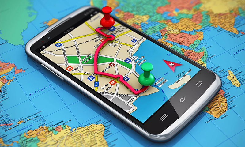
You can get lost not only in the woods or mountains, but also the labyrinths of unfamiliar streets. It is easy to avoid this even without a call to relatives, if you learn how to use and pre-install special navigator programs on your smartphone or tablet. Their number is capable of confusing and sophisticated user. Therefore, we have prepared an overview of applications for Android, which according to statistics are the most frequently downloaded.
Content:
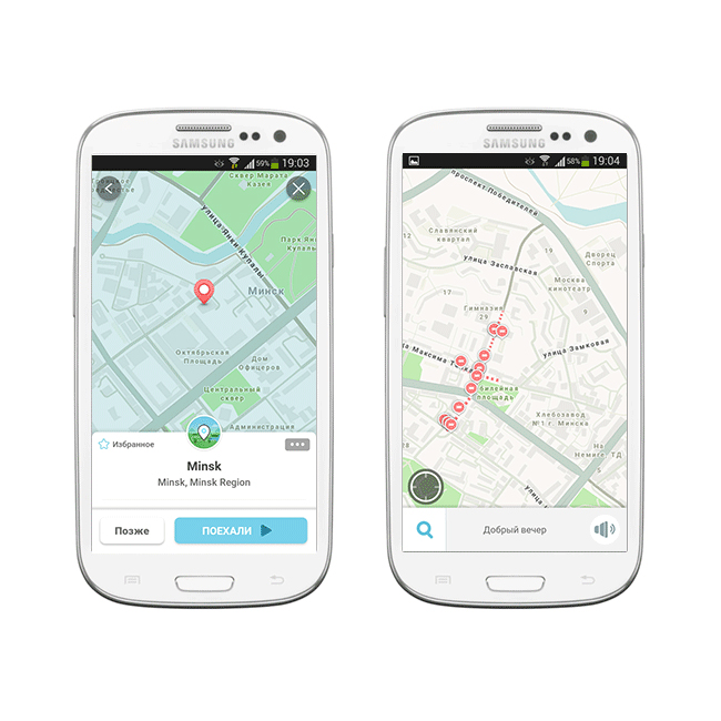
Yandex - navigator for geolocation in the CIS countries
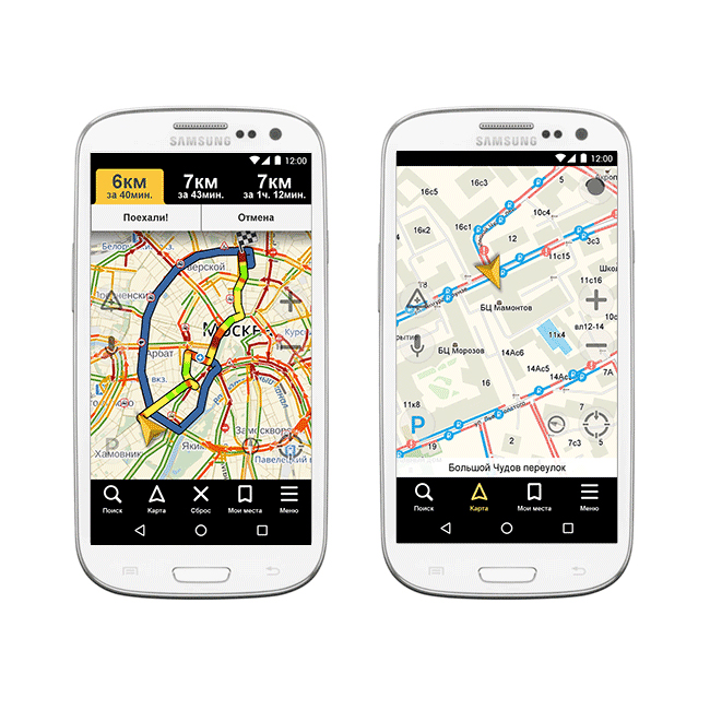
The service is free and easy to download on a smartphone or tablet, easy to manage. It contains a wide range of functionality for motorists, not only offering the 3 best routes to the desired object, taking into account speed and convenience when driving, but also informing about traffic jams, accidents, repairs on roads with detours.
For independent backpackers, the application will help you choose transport, indicate the transfer points, cafes, ATMs and the rest of the infrastructure.
Benefits:
- does not take much space in the memory of the gadget;
- recommends several route options to choose from;
- the interface has a convenient structure;
- there is a night GPS mode;
- detailed set of POI objects;
- voice control option;
- warns of speeding;
- saves routes.
Disadvantages:
- effective mainly for the CIS countries, when traveling on other routes it is recommended to choose another program;
- limited offline functionality.
Waze - Universal Assistant
Navigator is called combined for its ability to work without problems in conditions of poor communication or offline. The program automatically switches to it when there is no Internet.
Compatibility with GLONASS and GPS allows you to pave the way in accordance with the operational situation on the roads, which is reported by the users themselves thanks to a specially provided warning system.
A laconic interface, a useful option for caching maps, a detailed infrastructure in the database, an internal rating system for car enthusiasts and tourists - all this draws attention to the resource.
Benefits:
- smooth operation in any conditions;
- use of maps City Guide and OSM;
- operational data for the route is automatically loaded;
- in memory remain frequently visited objects;
- voice search and tips;
- alert system, including relatives and program participants;
- free application.
Disadvantages:
- lack of 3D mode.
OsmAnd - for offline users
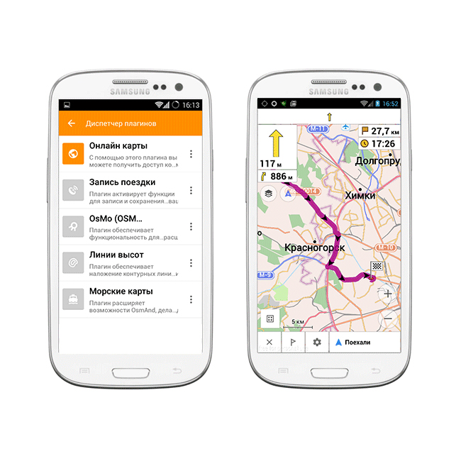
Those who go to a place with difficult terrain or prefer to relax without online, can not do without this useful service. It is enough to get access to Wi-Fi once and download the necessary raster and vector maps of Open Street Maps.
All objects are plotted in as much detail as possible and are shown in 3D-format; map editing is available. Plug-ins increase the capabilities of the project, turning it into a multifunctional.
Benefits:
- works well without an Internet connection;
- detailed maps;
- automatic switch to day / night mode;
- supports 3D format;
- possible expansion of functionality with plugins;
- voice control;
- profile switching;
- system of internal purchases in the service;
- The project is actively developing.
Disadvantages:
- free download only up to 10 cards.
2GIS - not only for Apple
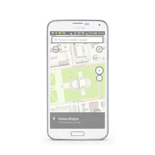
Another popular offline program that does not require constant access to the network. It is easy to travel with her not only in the CIS, but also in the Czech Republic, Cyprus, Chile and the United Arab Emirates. Not only settlements but also countries very quickly join the application.
Detailed maps with plotted infrastructure are useful in drawing up the shortest route with a fixation in time. The resource is useful and detailed base of public transport, companies, government agencies, etc.
Benefits:
- simple resource structure;
- offline operation;
- a large database of companies with a mode of operation, which is updated quickly;
- detailed maps with house numbers with m .;
- voice prompts for motorists;
- free use.
Disadvantages:
- not found.
Pay application Navitel
Navigator has a rich functionality that is useful for vehicle owners and pedestrians. Support for offline mode along with work on the Internet creates all the convenience of using it in 64 countries around the world.
An SD card is provided for storing cards. The entire route is laid bypassing traffic jams, road accidents. The application integrates a warning system for traffic cameras and other means of observation.
Benefits:
- convenient interface sections;
- compatibility with both GPS and GLONASS;
- built-in on-board computer;
- there are voice prompts;
- card rotation function;
- night and day skins;
- many useful options.
Disadvantages:
- limited functionality in the 7-day demo version.
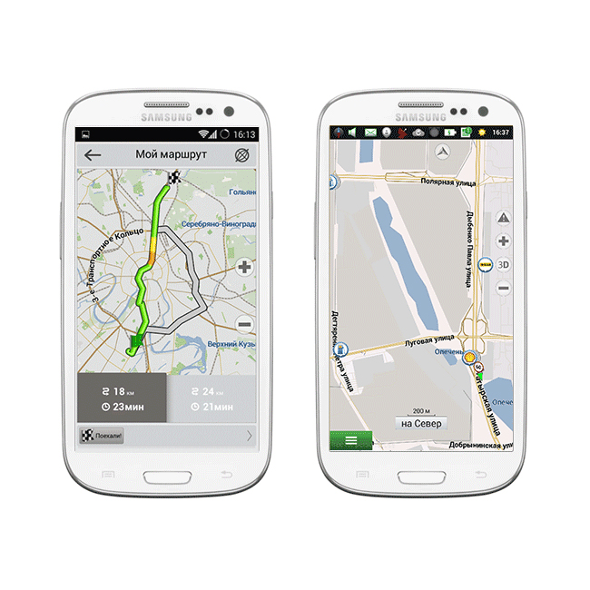
Seven Roads - a resource with great potential
The service works efficiently in online and offline modes. You do not have to get used to its menu, since the interface is adapted to the style of Windows 8/10.
Using the library OpenStreetMaps allows you to lay the optimal route with a length of even more than 10,000 km and change it without consequences. If necessary, you can quickly download additional extensions.
Benefits:
- familiar interface;
- compatibility with both GPS and GLONASS;
- automatic saving of routes;
- HUD mode;
- voice prompts;
- there is a speedcam plan;
- You can create your own maps.
Disadvantages:
- There is not always good compatibility with online resources.
It will be interesting to friends too